SeeShore
see beyond the sea
See what’s across the water.
SeeShore uses augmented reality to label the far shore you’re looking at—towns, capes, islands, and points of interest. Point your phone, get the name, tap for details, and explore a 3D coastline.

* Publicly available app experience used in commerce.™
Loved by coastal walkers, sailors, photographers, and the just-plain-curious.
What SeeShore does
Instant, accurate labeling of the opposite shore—with rich context and an AR interface designed for clarity outdoors.
Point & identify
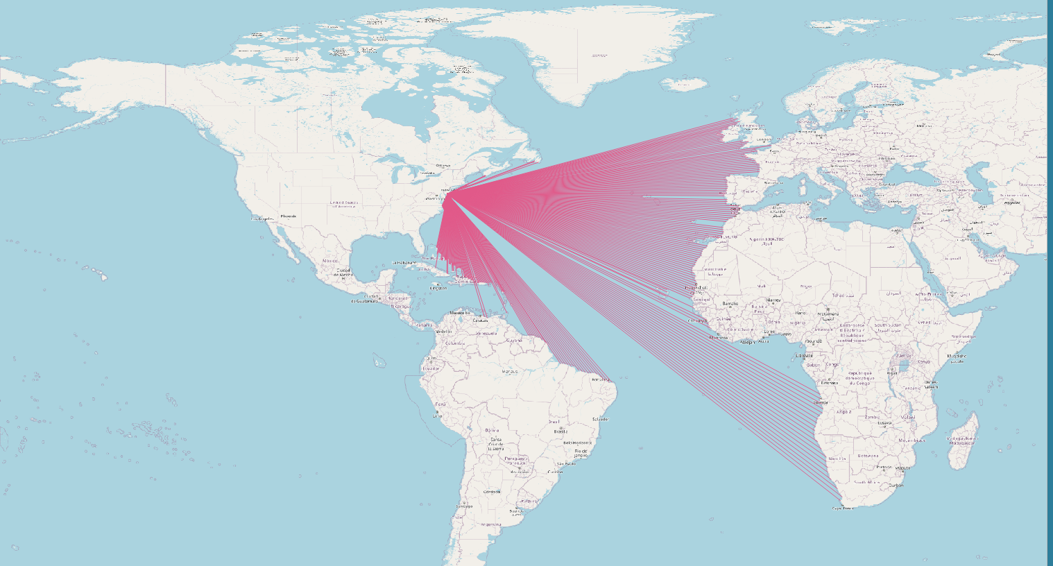
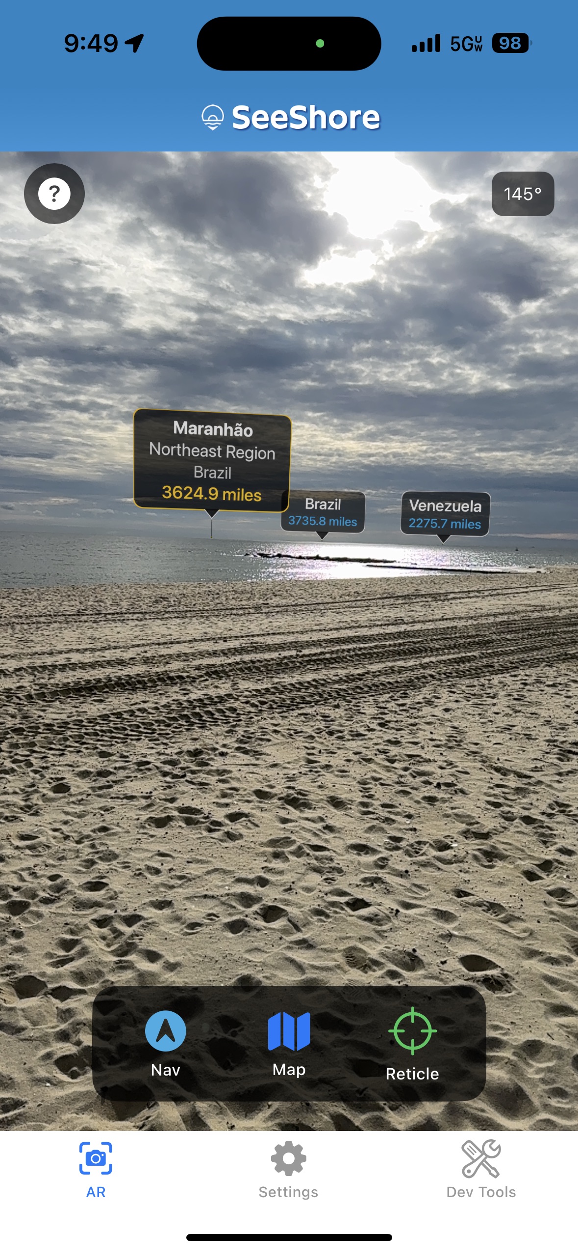
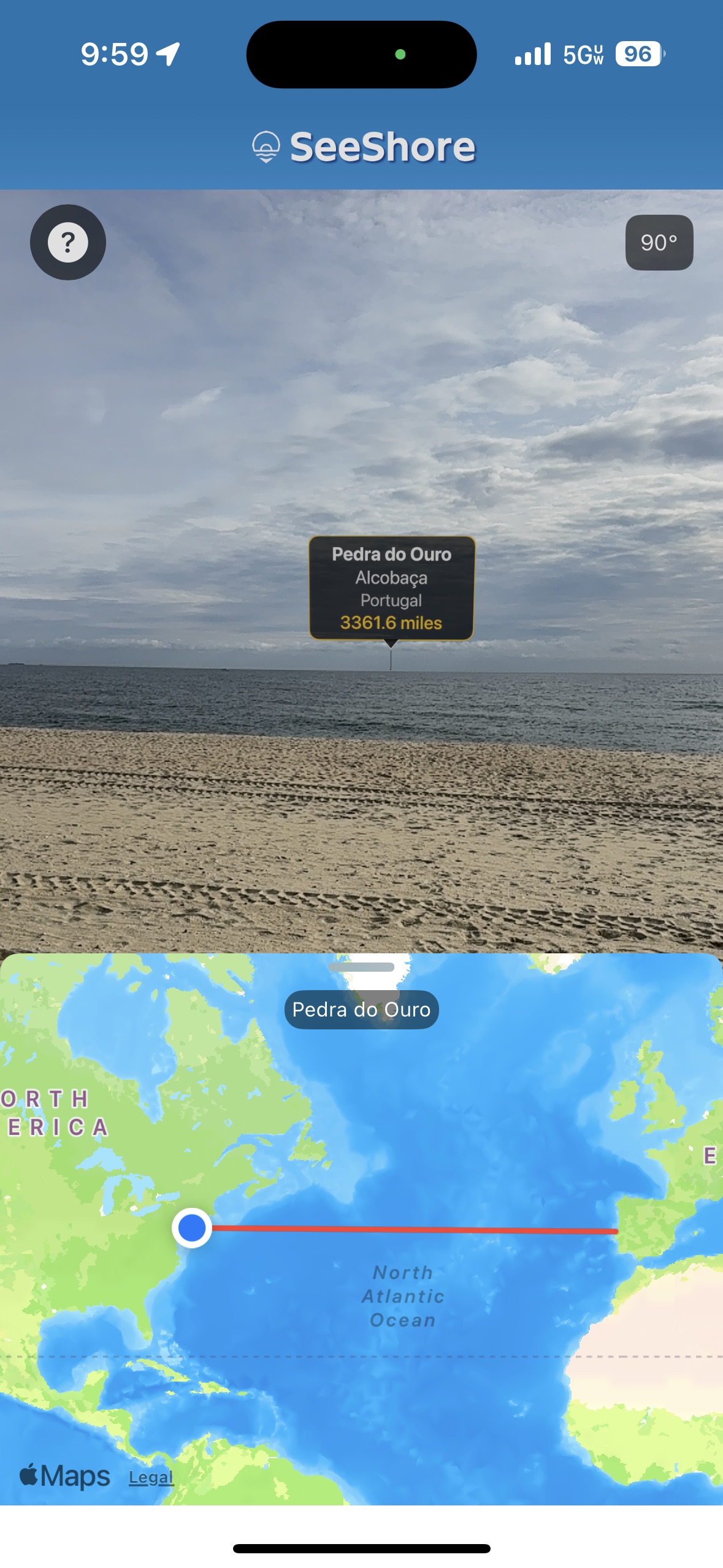
Aim your camera across the water. SeeShore finds the first visible land and names it.
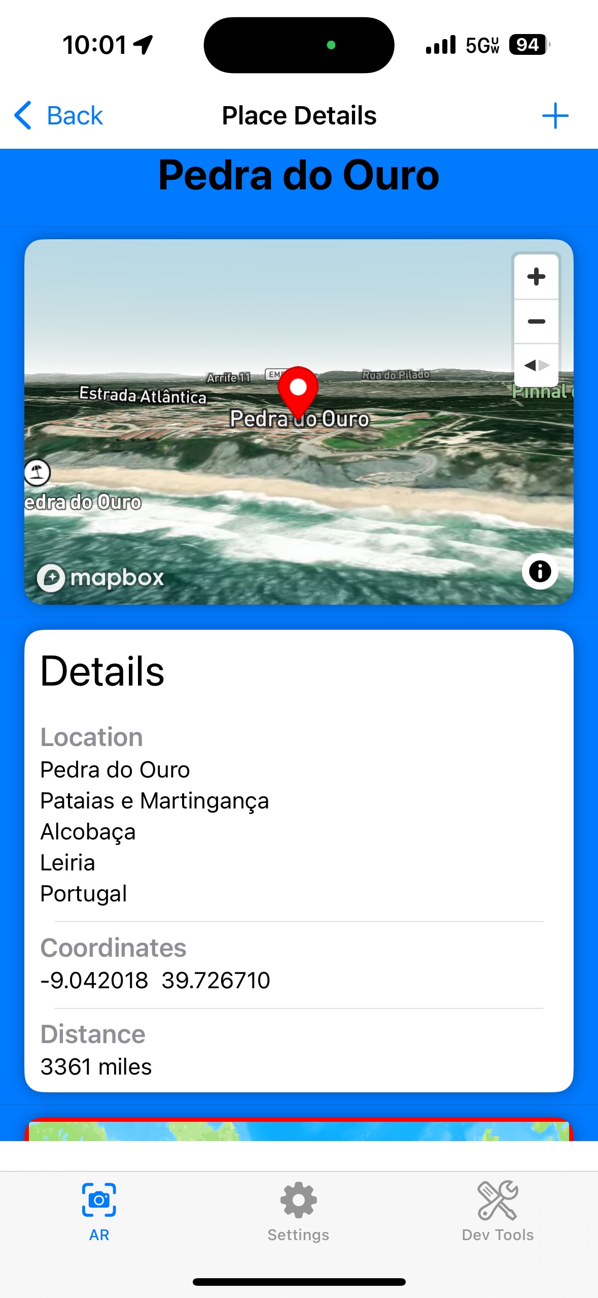
Tap for details
Get bearings, distance, lat/long, and a link to Wikipedia right inside the app.
3D coastline view
Explore a Cesium‑powered 3D model of the shoreline to understand the lay of the land.
How it works
- 1. SeeShore determines your precise position and heading.
- 2. Our engine intersects your line of sight with global coastline data to find the body of land beyond the horizon.
- 3. The app overlays a clean AR label; tap to open details and a 3D view.
Fast • Accurate • Built for the horizon
Adaptive azimuth scans • Global coastlines • Offline caching
A clean outdoor UI
Bright labels, legible type, and minimal chrome so the scenery stays the star.
“Finally, a way to answer ‘what town is that?’ without guessing.”
“As a sailor, this is brilliant for planning and sharing anchorages.”
“My photography tours love the context overlays—super helpful.”
FAQ
What phones does SeeShore support?
iPhone models running iOS 16 or later. AR features require a device with A12 or newer.
Do I need cell service?
Basic identification works offline after initial data sync; rich details and sharing require connectivity.
What data do you store?
Only what’s needed for your account and posts. See our privacy policy for details.
Can I suggest places?
Yes! You can submit points of interest; the community helps review and refine them.
Ready to SeeShore?
Grab your phone, head outside, and point across the water. The opposite shore—named.